
Pisgah National Forest: The Whole Enchilada (Pilot Rock to Black Mountain)
- Matt Overton
- Jul 15, 2025
- 3 min read

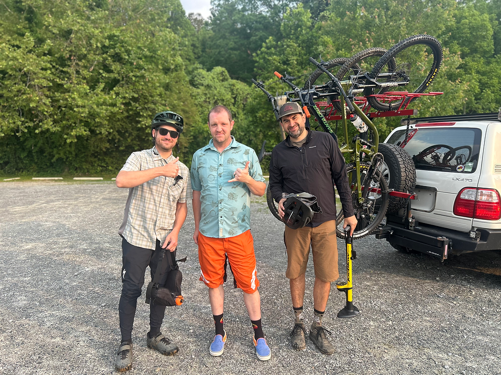
The Whole Enchilada is what locals call an epic day on the bike that starts and Pilot Rocks and ends after running 3 sections of the Black Mountain trail. My buddy Mac informed me that he had never ridden Pilot Rock and wanted to check it off his bucket list. So we came up with a plan to run the Whole Enchilada on an early summer Saturday. This route starts at the Blue Ridge Parkway with a shuttle drop-off at the Pisgah Inn. Thanks to my amazing wife for driving the early morning shuttle for us!
After being dropped at the Pisgah Inn, we pushed our bikes to the start of Pilot Rock. Pilot is one of my favorite Pisgah trails, it is very remote and if you don't shuttle, it involves a 7 mile singletrack climb up Laurel Mountain. Pilot starts with a fast and flowy descent that is somewhat technical. Then you hit the rocks and switchbacks, lots and lots of technical rock switchbacks. Which eventually give way to a giant rock garden and a straight downhill rip to end the trail. I am not sure how many switchbacks the trail has, but my estimate is 20. If you ride all the Pilot switchbacks without dabbing, you truly are an amazing rider!

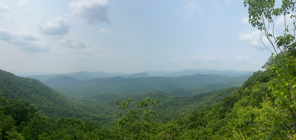
Pilot Rock takes you to Yellow Gap Road, where you turn right on Yellow Gap Road (gravel) until you reach Wolf Ford Horse Camp. At Wofl Ford, turn left on FS476 which becomes South Mills River. You take South Mills River for about 2 miles and then you turn right on Buckhorn Gap Trail. You take Buckhorn for 1.7 miles. Yellow Gap, 476, South Mills and Buckhorn Gap are all double-track or very wide singletrack. There are some fun sections, but it mostly feels like mild gravel climbing. Buckhorn Gap Trail takes you to the intersection of Clawhammer Road and Upper Black Mountain. At this intersection, you could go right on Upper Black (also called Upper Upper Black or Shelter Black). This will take you to the very popular 4 way intersection with Avery Creek, Buckwheat Knob, and Club Gap. We chose to go left at the Clawhammer/Upper Black intersection, which takes you to Upper Black. This is least fun part of the ride as it starts a 30 minute hike-a-bike up very steep terrain. Towards the end of the hike-a-bike, there is a great overlook with views of Looking Glass Rock. Be very aware here Timber Rattlesnakes like to hang out on the rock, including the biggest one that most have ever seen! It is a great spot for some photos though.
Upper Black Mountain eventually flattens out and you start the descent at the intersection with Turkey Pen Gap. This is a very fun downhill that is both technical and flowy. This section of Upper Black was recently re-worked and is very fun to ride. You have approximately 2 miles of downhill until you reach the intersection with Maxwell Cove, which starts the Middle Black Mountain segment of the trail. This segment starts with a brief climb and then another mile or so of downhill. This section of trail was also recently re-worked. Middle Black intersects with Thrift Cove, which starts the final downhill section of Black Mountain called Lower Black. Lower Black offers another mile of downhill and is flowy with several rock gardens mixed in. It is a very fun downhill section of trail. At the end of Lower Black you will keep going downhill back to the parking lot. You can also ride the greenway or road back to The Hub, which is what we did. Overall it is approximately a 16 mile route with 1,700 feet of climbing. You can check out the route on Strava. Now go reward yourself with lunch and beers at The Hub!


Comments